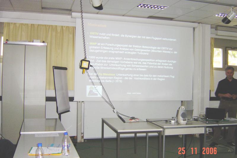
Workshop Meteorological Panel24 - 26 November 2006
|
Saturday 25th
Forcasting
The LMK (2.8 km horizontal resolution) is nested in the 7 km-LME which
is nested in the 40-km GME model. This development is since August 2006.
Impressive predictions of a meso-cyclone associated with a tornado and
predictions of a squall-line were presented. Predictions of mountain
wave occurrence with satellite image verification as well as data from
flight-recorders of gliders demonstrated the accuracy of the wave
forecasts. This DWD product which in available in the on-line pc_met
system is a valuable addition to forecasts for the central and
northern-European glider pilots.
PDF (3 Mbyte)
Mountain Waves
HEROLD video:
A Stemme S10 (K. Ohlman's) was the measurement platform.
Forecasts used for flight planning were produced by the "Amt fuer
Geowissenschaften der Bundeswehr" (Office for Geoscience of the German
military). A tool to visualize the forecast for the relevant part of the
Andes was made available by the German Meteorological Service (DWD)
through the internet application pc_met. The Argentinian Air Force
provided additional local meteorological aassistance. Instruments:
Best-aircraft turbulence probe (BAT-probe for 3-D air motions), temp,
moisture, detailed navigation, etc ... One goal was to break Kuettners's
German absolute altitude record (Bishop wave).
HEISE brief:
MWP Motivation: 1999-Science and record flying, poster presentation at
an Innsbruck mountain meteorology meeting.
2006 (October-November)-scientific objectives, explore turbulence and
flight safety on air routes over Andes into Santiago Chile. Help improve
Andes crossing procedures through observations, measurements and
numerical simulations.
Qualitative results, to date, have revealed unexpected air motions,
perhaps unique to the location (different than those experienced further
south) and currently unexplained. Data are freely available ( ) and
analyses are encouraged in an attempt to explain the unexplained
phenomena.
Due to the excellent support of the Argentinean Airforce (F.A.A.)
the OSTIV expedition to the ACONCAGUA was a great success.
PDF (0.9 Mbyte)
Visited a Norway wave camp (temporary membership in technical university
flying club so he could use club equipment).. Oppdal is just south of
Trondheim in the high mountains (about 2000 m MSL, valley bottoms 500m).
At 63N, still thermals! Wave flying in cloudy conditions; flew in a
Foehn Gap, 1-2 m/s. On a rotor-cloud (roll cloud?) flight 9 m/s climb
but not too turbulent due to "round-top" mountains! Showers and
overcasts sometimes limited the flights. Awesome!
PDF (1.4 Mbyte)
Extension of the infamous Sierra Wave Project. Occurred in the Winter-Spring 2006. Explore the "Sierra-monster": the rotor. Inspired, in part, by the "Second-most famous wave picture" (the first being the Omamara wave (EEH), the famous the Bob Symons P-38 flight. Thoroughly instrumented: surface, remote and airborne; international in participants. Preliminary results presented at Am. Met. Soc. mt. meteor. meeting, Santa Fe NM Sept. 06 (papers on AMS website). Showed wave-rotor structure from vertically pointing lidar detecting an aerosol layer.
"Wave simulations in a fluid-tunnel", re-enacting a historic experiment. An instructive animation showing a fluid flowing down-stream of a barrier.
Convection
A schematic was presented showing a postulated mechanism for the
artificial development of convective clouds at the land-sea interface.
The development of the convection is expected to be enhanced by altered
surface conditions (optimum vegetation plus moisture released in the
flow into the convection). The resulting shade from the convective
clouds is to promote agriculture (enhancement of vegetation) ashore. If
the technique is shown to be feasible, it could be helpful for arid
coastal regions.
PDF (1.5 Mbyte)
Low profile, low budget, expensive beer and difficult weather! But, lots
of actual weather information via Internet (wireless access): thermal
models, forecast soundings, high-resolution satellite and radar images,
Power Point briefings. Task setter did not use TopTask because it did
not contain "local knowledge". Forecasts not perfect - but no big
mistakes. 15 out-of 28 teams asked for the free pc-met/TopTask system.
Ten competition days out of 13 possibilities. Safety issues: short
field, start gaggles, "rough (undisciplined)" flying and flying over
un-landable terrain.
PDF (0.6 Mbyte)
LORENZEN showed photos of the weather from WGC 2006. The photos triggered much discussion about the frequent wave clouds.
Regional thermal forecasts: areas with similar topography, ground cover
and produce relative uniform cloud bases and lift rates in convection.
Strataform clouds predicted from numerical weather prediction model and
cumulus convection predicted from imbedded convection model (REGTHERM).
Flight planning accomplished using characteristics of glider,
characteristics of the thermals and speed-to-fly theory. Essentially
"fly" the glider through the predicted weather (regional thermal
forecasts). Compare the actual task speed with predicted task speed to
validate thermal forecast. If actual and predicted speeds comparable,
thermal forecast "accurate". If actual speed > the predicted speed,
pilots flew "aligned lift" (not simulated in thermal forecast). If
actual speed < than predicted speed the forecast is "inaccurate" eg.
frontal passage miss-forecasted causing pilots to make big detours.
The validation used with TOPTHERM and HIRLAM models for same forecast
regions. Found HIRLAM over predicted giving guidance to "tuning" the
HIRLAM model. Also, TOPTEHRM predictions compared with actual flights in
Reiti and Vinon and showed actual speeds systematically greater than
predicted speeds. So, the "speed-to-fly" theory which, up to this point,
had still air between thermals had to simulate ridge, wave and cloud
street lift between thermals. Then, ridge lift was parameterized, the
DWD LMX model calculates wave lift and cloud-street lift was
parameterized. These lift sources were added to the convection lift
rates. And, the first validations of flights in dynamic lift are
encouraging. This product is four days old! Stay tuned!
PDF (0.6 Mbyte)
The authors from Turkey could not come themselves to Berlin and present their papers, but sent an abstract and a power-point presentation.
The main aim of this study is to analyze temporal and spatial variations
of vertical velocity in Turkey. Daily programs of gliding activities are
based on convection potential in flight area. Vertical velocity,
vegetation cover, daily heating rate, instability conditions and heat
fluxes have a key role on prediction of flight lengths. The favorable
gliding conditions are available in late spring, summer and early autumn
in Turkey. In this study, NCAR - NCEP reanalysis data (00:00GMT) are
considered. Vertical velocity variables and vertical velocity components
at three different layers (1000hPa, 925 hPa and 850 hPa pressure levels)
have been evaluated at 50x50km grid points in Turkey. Spatial and
temporal variations of vertical velocity variables and speed components
have been compared with radiosonde data and the PCMET outputs for
selected cases.
PDF (0.6 Mbyte)
Status of discussion as of Eskilsuna OSTIV Congress, 14 June 2006:
At the end of the OSTIV Congress, the Met-Panel met to discuss the IGC
request to develop criteria to identify "thermal-only" flights for
record purposes. No definite criteria could be established, so the
recommendation to IGC will be to have record flights also categorized by
regions, eg. Australia, Africa, N-America, ect.
Hans-Werner GROSSE:
He outlined the history of record flights using "thermals". He stated
there is still room to expand the achieved speeds. But, now "surfing the
wave" in Argentina has pushed the speed limits further. It's the desire
of IGC to discern world records between pure "thermal", pure "wave" and,
perhaps, mixed.
Grosse's suggestions to discern a "pure" thermal flight:
He further stated the potential in the wave (speed and, hence, distance) is so much, even for a poor pilot, that a non-top pilot can set a world record in wave but can't even place in a competition. So, world record flights must be set in thermals to challenge existing world records which were set in pure "thermals".
He proposed the following analog: we want to have a "high jump" flight category and a "pole vault" flight category.
Sunday 26th
Continued discussion: Report of the IGC Bureau about "thermal records"
Summary of discussions:
This text should be sent to IGC.
It is difficult, on the basis of .igc files alone, to make a clear distinction
between flights using only thermal convection and other flights. Additional local
meteorological data and further study would be necessary to unambiguously define
a "thermal-only" flight.
TS published continuously since 1971. A temporary interruption (2004-2005) has occurred and recovery is underway. Proposed future developments: become web-based, achieve learned-journal status and initiate reviewed and non-reviewed sections.
WMO has agreed to publish a third edition. Working group was setup in Turkey 2005. Liechti is implementing a mechanism for the group to begin meeting and initiate the required study.
IGC needs expert advice to the viability of:
Additional comments:
Next Met Panel meeting:
Flying session St. Auban or Serres, 24-28 Sept 07; scientific sessions 29 Sept 2007,
Sept. 2008, Meteo Swiss-Zurich (tentative, depending on accommodation price).
Recorder Edward (Ward) Hindman (USA),
Chairman Hermann Trimmel