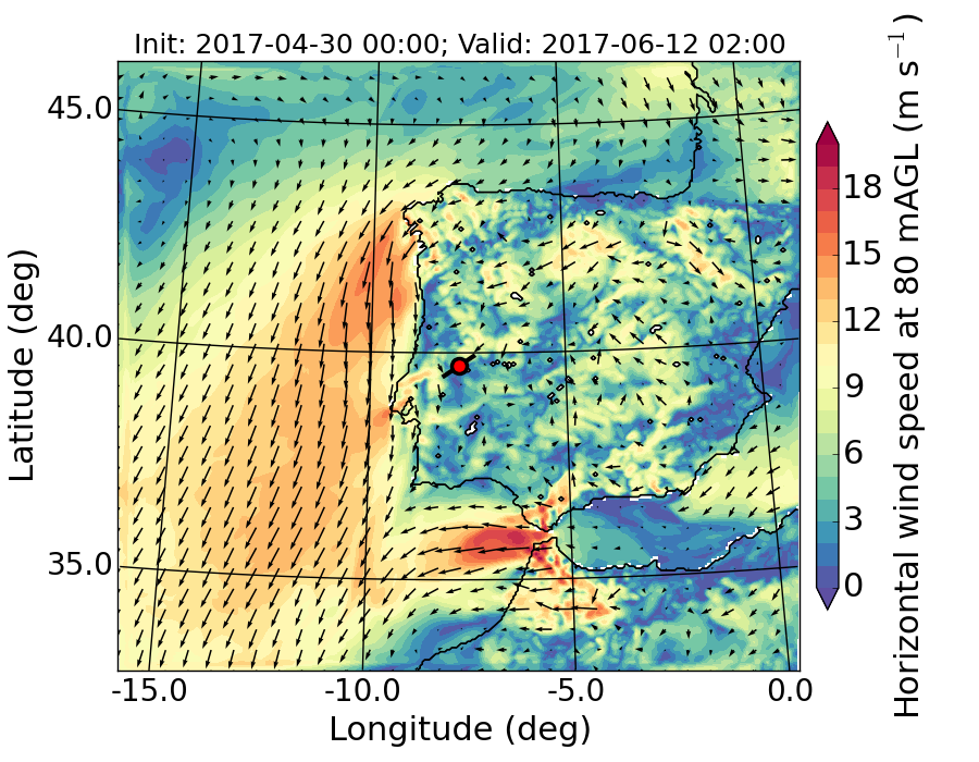
The experiment
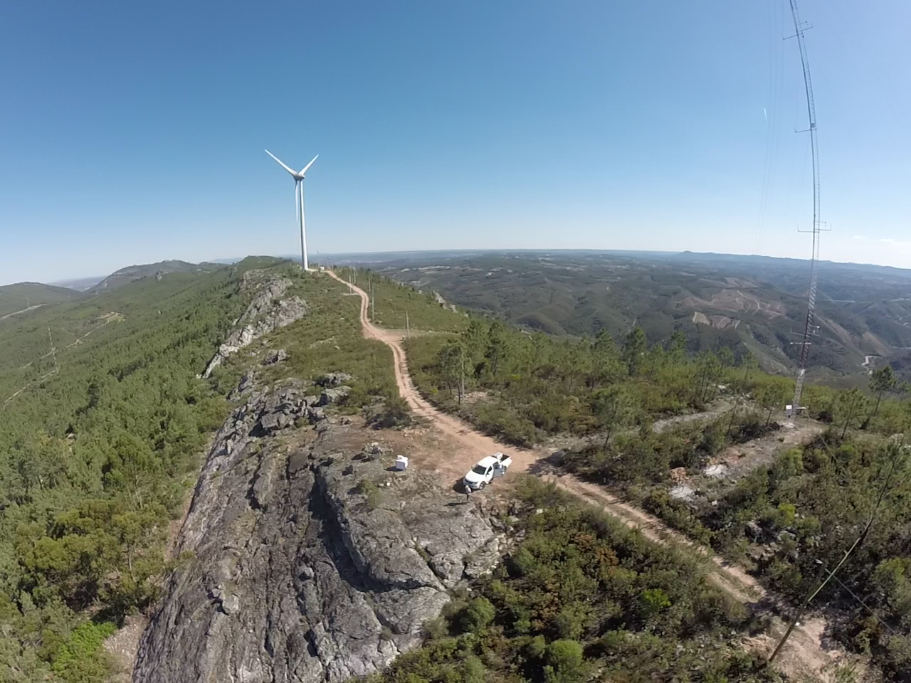
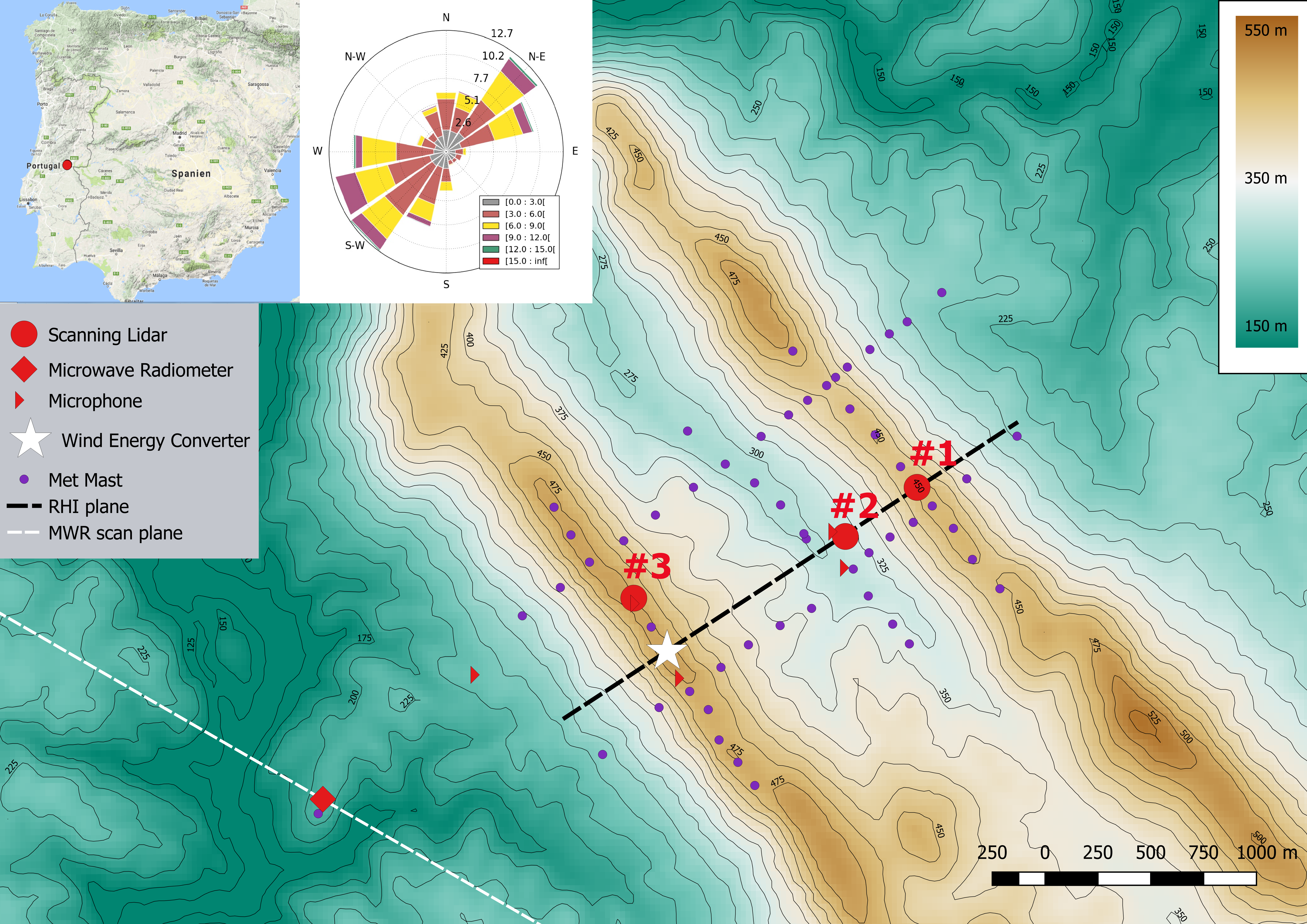
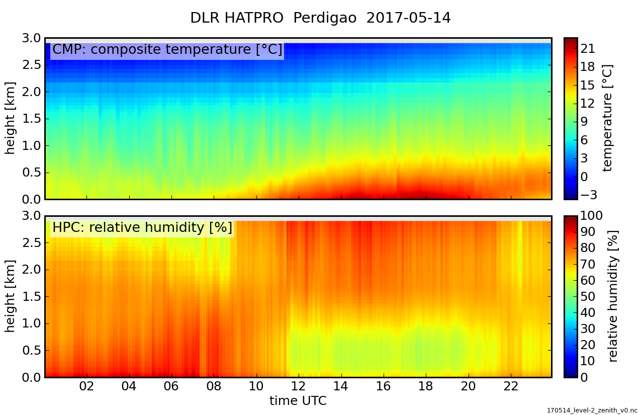
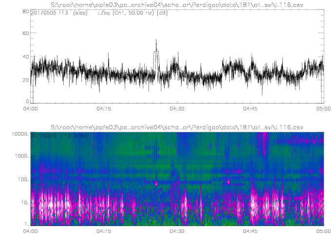
In Europe, wind energy plant operators are forced to search for sites in complex terrain and are increasingly confronted with challenges in convincing local residents of the further expansion of onshore wind energy. One reason is the periodic noise emitted by the wind turbine. A reliable assessment of noise pollution is therefore indispensable for a successful siting of single or multiple turbines. Turbine wake flow in complex terrain is a challenging task and sound propagation depends on topography and the local flow conditions. Hence, DLR research at the Perdigão measurement campaign aimed at measuring the turbine inflow and wake flow with scanning lidars under various meteorological conditions together with a microwave radiometer (MWR) to assess the thermal stratification of the atmosphere. These measurements were accompanied by five fixed and two mobile microphones simultaneously recording sound levels at selected locations in the surrounding of the wind turbine in order to obtain the local distribution and temporal variation of sound immission. The aim is to correlate specific flow dynamics in the complex terrain around the wind energy converter (WEC) on the southwestern ridge with these sound measurements.
More information on top-level goals of the Perdigão campaign and access to the data can be found through the project websites:
perdigao.fe.up.pt
www.eol.ucar.edu/field_projects/perdigao
Overview paper:
Fernando, H., J. Mann, J. Palma, J. Lundquist, R. Barthelmie, M. BeloPereira, W. Brown, F. Chow, T. Gerz, C. Hocut, P. Klein, L. Leo, J. Matos, S. Oncley, S. Pryor, L. Bariteau, T. Bell, N. Bodini, M. Carney, M. Courtney, E. Creegan, R. Dimitrova, S. Gomes, M. Hagen, J. Hyde, S. Kigle, R. Krishnamurthy, J. Lopes, L. Mazzaro, J. Neher, R. Menke, P. Murphy, L. Oswald, S. Otarola-Bustos, A. Pattantyus, C.V. Rodrigues, A. Schady, N. Sirin, S. Spuler, E. Svensson, J. Tomaszewski, D. Turner, L. van Veen, N. Vasiljević, D. Vassallo, S. Voss, N. Wildmann, and Y. Wang, 0: The Perdigão: Peering into Microscale Details of Mountain Winds. Bull. Amer. Meteor. Soc., 0, https://doi.org/10.1175/BAMS-D-17-0227.1