Passive Remote Sensing
During the last years, researchers at the Institute of Environmental Physics, University of Bremen, Germany, demonstrated that emissions of strong and localized emitters of CH4 and CO2 can be quantified independently using passive remote sensing of the atmospheric distributions of CH4 and CO2.
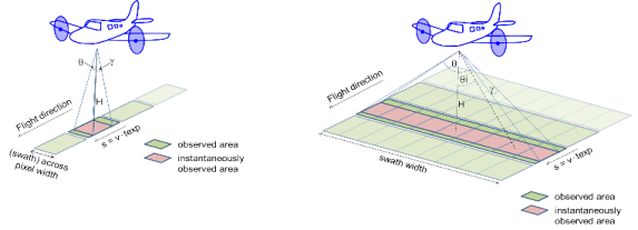
The current system – Methane Airborne Mapper (MAMAP) – is a 1-d (one measurement across track, continuous measurements along track, see figure) performing precise along track “mapping” of atmospheric CO2 and CH4 distributions around a strong emitting point source. With MAMAP (1-d) it has been demonstrated that emissions from strong and localized point sources like power plants (CO2), coal mines (CH4) and landfills (CH4) can be determined quantitatively. Important error sources are related to the knowledge of changes in meteorological conditions (wind direction, wind speed, etc.) during the measurement duration of typically several hours. These error sources can be minimized with a 2-dimensional imaging spectrometer with similar single-pixel performance as MAMAP just by reducing the measurement time (1-d vs. 2-d). This allows reducing the detection limit and sensitivity to smaller point source emitters by approximately an order of magnitude compared to MAMAP.
The goal within AIRSPACE is therefore to build, test, and apply an airborne 2-d imaging greenhouse spectrometer (MAMAP2D) with a strong MAMAP heritage to demonstrate the advantage of 2-d GHG imaging for independent quantification of CO2 and CH4 point source emissions, and to develop the respective retrieving algorithms.
 Not directly part of
AIRSPACE, but closely related is the deployment of
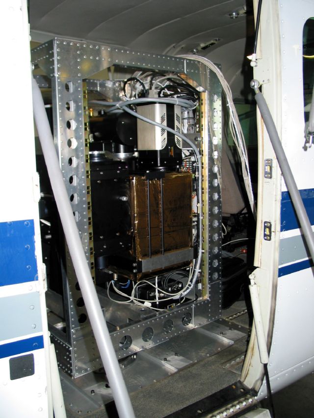
MAMAP (see right figure) during the CoMet campaign onboard the Cessna
207 operated by FU Berlin. This aircraft will perform coordinated
flights with both other aircraft. The individual data sets from each
instrument will be quality assured and merged for synergetic use.
Not directly part of
AIRSPACE, but closely related is the deployment of
MAMAP (see right figure) during the CoMet campaign onboard the Cessna
207 operated by FU Berlin. This aircraft will perform coordinated
flights with both other aircraft. The individual data sets from each
instrument will be quality assured and merged for synergetic use.
The validation of
current and upcoming greenhouse gas satellite
missions will predominantly be guaranteed by means of the
international TCCON network (Total
Carbon Column Observing Network). In addition to the stationary TCCON
spectrometers, mobile devices have been developed over the last few years.
Those have the advantage of achieving both the required accuracies as well
as mobility enabling their deployment in the field during dedicated
campaigns.
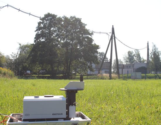
Within AIRSPACE, one of these mobile spectrometers (Bruker
EM27/SUN, see figure above) will be operated at the campaign location in
order to validate and reference the CO2 und CH4
columnar concentrations measured from the overpassing aircraft and
satellites. The figure shows such a device during a recent
deployment in the Upper Silesian Coal Basin (USCB).