Field Campaign - GWLCYCLE 2 - Scandinavia 2016
Home | Instruments | News | Forecasts | Quicklooks | Gallery | Contact | Links | Intern
DLR Falcon instrumentation
The DLR Falcon aircraft will conduct local research flights from the base at Kiruna. Its instrumentation will be similar to the one used for DEEPWAVE in New Zealand.
As a remote sensing instrument the 2 um Doppler wind lidar from IPA samples the disturbed wind field and gravity waves. The wind profiles are retrieved from line-of-sight measurements of the Doppler lidar by the velocity-azimuth display (VAD) technique. The instrument performs a conical step-and-stare scan around the vertical axis with a nadir angle of 20 deg°. Combined with the movement of the aircraft, this results in acycloid scan pattern. The horizontal resolution of the wind profiles (5-10 km) is determined by the time needed for one scanner revolution (24 times 1 or 2 s as accumulation time per scan position, plus 6 s for the scanner motion) and the aircraft velocity (160-240 m/s). The vertical resolution of 100 m is determined by the pulse length of the laser [full width at half maximum (FWHM) = 400 ns (~120 m)] and the nadir angle of 20 deg. Nadir pointing measurements only without scanningmode will provide vertical winds in a horizontal resolution of ~ 200 m.
Falcon is equipped with an airglow imager by DFD, DLR (Carsten Schmidt,
Michael Bittner and Sabine Wüst). This allows to image gravity
waves and breaking during flight, i.e. also in cloud conditions when
Falcon flies above clouds.
HALO instrumentation
The instrumentation of the HALO research aircraft is described on the POLSTRACC Wiki.
Middle atmosphere lidars
|
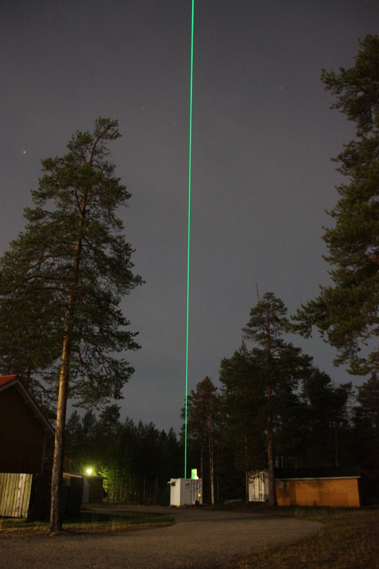
The CORAL lidar by IPA is a ground-based system installed at Sodankylä, Finnland. The system is housed in
an 8-foot container and consists of a laser emitter, trigger electronics, receiving telescopes, detectors and
controlling software. It will provide night-time measurements of density
and temperature (20-90 km).
|

|
Airglow
All three sites (ALOMAR, Kiruna, Sodankylä) are equipped with Advanced mesospheric temperature mappers (AMTMs).
Radiosondes from Kiruna
One system which is used is the GRAW DFM-09. The DFM-09 has a ceramic temperature sensor and a capacitive polymer humidity sensor. Pressure as well as wind are determined via GPS (global positioning system) data.
The accuracy of the measurements is < 0.2 K for temperature, < 5 % for relative humidity, < 0.3 hPa for pressure and < 0.2 m/s for wind speed.
The second system is a Vaisala Digicora MW41 sounding system with RS-41 radiosondes. The RS-41 has a platinum resistor temperature sensor with a total accuracy < 0.15 K for 1080-100 hPa and < 0.3 K for < 100 hPa. The capacitive humidity sensor has an accuracy of 2 %. The GPS determined pressure has an accuracy of 0.5~hPa for 1080-100~hPa and 0.2 hPa for 100-10hPa.
The GPS wind finding has an accuracy of 0.15 m/s in wind speed and 2
degrees in wind direction. Data are stored in 1~s interval. The mean
balloon ascent rate of 5~ms$^{-1}$ leads to a vertical resolution of
about 5 meters.
Radiosondes are also launched at ALOMAR and Sodankylä.
Wind radars at Andenes
The MAARSY radar at ALOMAR can be operated in troposphere mode to
measure zonal and meridional wind around the Falcon flight
altitude.
The meteo radar provides zonal and meridional winds in the upper
mesosphere.