Middle Atmosphere Group, DLR-IPA
Research | Instruments | Campaigns | Publications | Links | About us
Campaigns
WAVEGUIDE
Date: Nov-Dec 2026 |
South Pole
Date: 2023--2026
Instruments: TELMA lidar
Base: Amundsen-Scott South Pole station
Dataset: 3 summers
HELIX, Oberpfaffenhofen
Date: winter 2023/2024
Instruments: He-Lidar
Base: Oberpfaffenhofen
SouthTRAC-GW, Tierra del Fuego and Antarctic Peninsula
Date: September-October 2019
Instruments: ALIMA lidar, GLORIA, radiosondes, gliders
Platform: HALO
Base: EARG Station in Rio Grande, Tierra del Fuego, Argentina
Map: from Fig. 5, Rapp et al., BAMS, 2020
Dataset: seven research flights of approx. 7000 km each
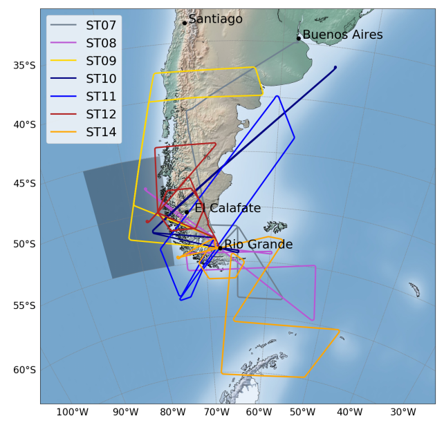
- Campaign website
- Overview Paper: Rapp et al., BAMS
- Data on HALO-DB
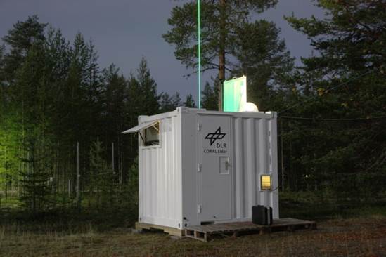
SOUTHWAVE, Rio Grande, Tierra del Fuego, Argentina
Date: since Nov 2017
Instruments: CORAL lidar
Platform: Ground-based
Location: EARG Station in Rio Grande, Tierra del Fuego, Argentina
Coordinates: 53.79
S, 67.75 W
Dataset: 4000 h
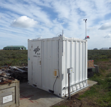
- Campaign website
- Overview Paper: Reichert et al.
- Data on HALO-DB
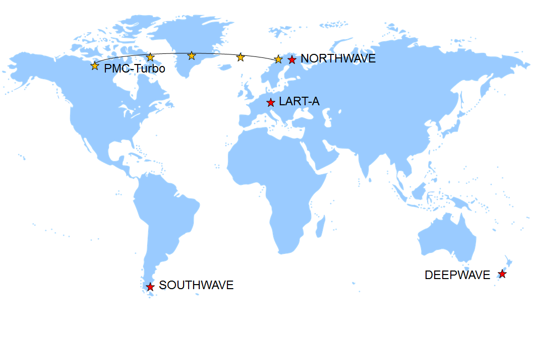
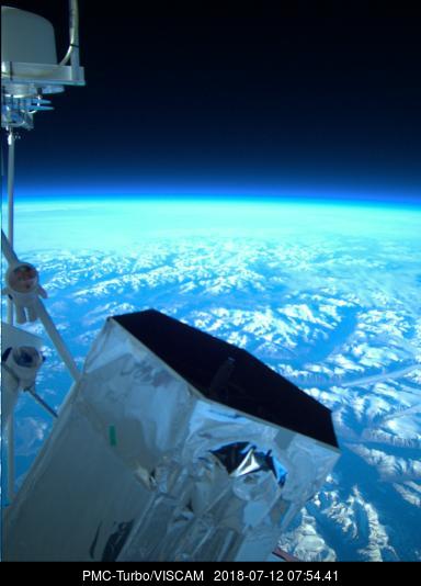
PMC-Turbo, Arctic
|
Date: 8 - 14 July 2018 PMC-Turbo is a long duration balloon mission of NASAs sumemr 2018 balloon programme. PMC-Turbo is dedicated to the study of noctilucent clouds or polar mesospheric clouds by lidar and camera from a balloon-borne platform. The balloon flew from Kiruna, Sweden to western Nunavut, Canada during almost six days at 39 km floating altitude. Several cameras provided high-resolution NLC imagery, and the BOLIDE lidar high-resolution vertical soundings of the mesospheric ice layers as well as temperature and gravity waves above the balloons floating altitude. |
|
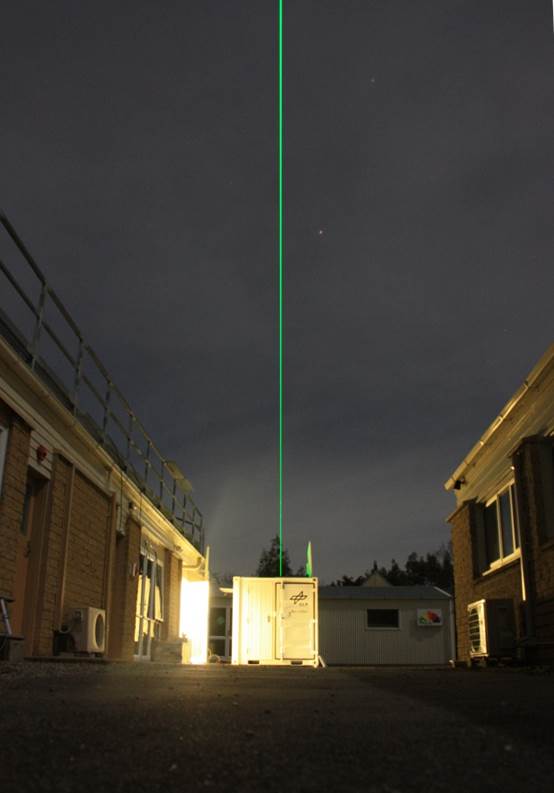
LART-A/ARISE-2, Bavarian Forest, Germany
Date: May 2015 - Sep 2016
Instruments: CORAL lidar
Platform: Ground-based
Location: GERES station atop Sulzberg, Bavarian Forest, Germany
Coordinates: 48.84 N,
13.67 E
Dataset: 485 h
CORAL was set up close to Oberpfaffenhofen in order to facilitate easier access for upgrade of the instrument before shipment to south America. It was deployed to GERES station atop Sulzberg in direct vicinity of the infrasound array I26DE within the ARISE-2 Eu project. The lidar continuously performed middle atmospheric soundings for temperature, waves and clouds.
GW-LCYCLE2, Scandinavia and NORTHWAVE, Sodankylä, Finland
|
Date: Sep 2015 - April 2016 |
|
The GW-LCYCLE2 field campaign was a coordinated effort including the flights with the multi-instrumented Falcon aircraft, radiosonde launches from Esrange, Kiruna, Sweden and lidar operations in Sodankylä, Finland, Kiruna, Sweden and Andøya, Norway.
DEEPWAVE, New Zealand
Date: June - November 2014 |
|
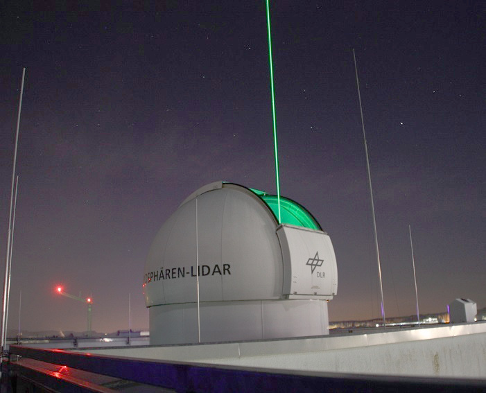
First light, Oberpfaffenhofen
|
Date: since March 2014 First light of TELMA was in March 2014. Since then we test laser and instruments atour institute at Oberpfaffenhofen during development and before shipment. |
|